LIDAR Rock R3 Recap
Modular Lidar system for both drone and handle held applications
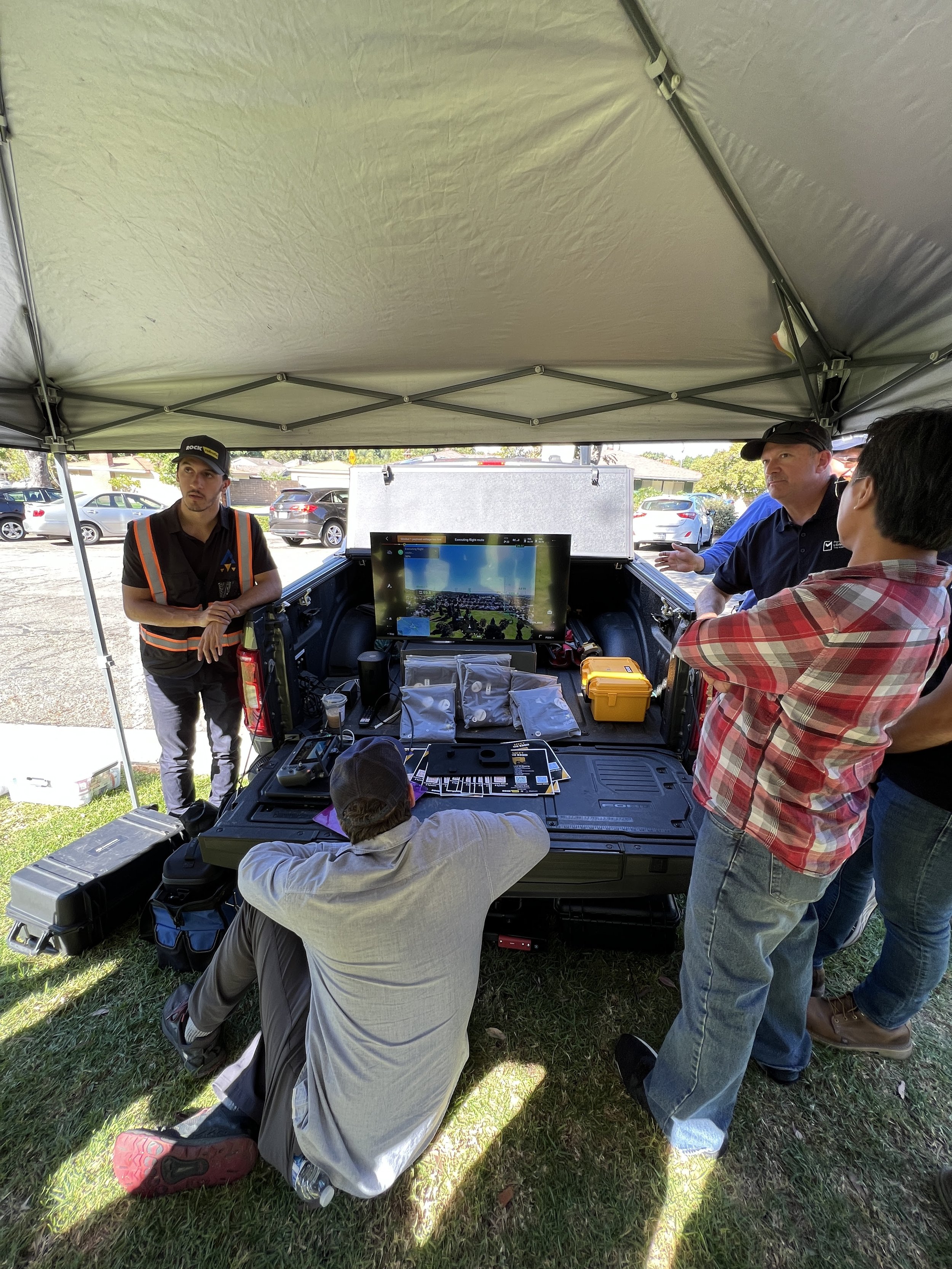
On Tuesday October 31, Sensofly took a hands on class with the Rock Robotic R3 Pro Lidar system mounted on a DJI Matrice 300 drone. We were able to generate 8 acres of 3cmm precise point cloud data in just 10 minutes of flight! After the flight, additional ground data was captured using the same Lidar system. We processed the data right in the field and uploaded it to the cloud (our example data was less than 1 gig).
Overall a very impressive system. If you are able to make a $50,000 investment ($30,000 for Lidar, $10,000 for software subscription, $10,000 for a DJI Matrice drone), you will find yourself situated in a lucrative market. Sensofly will eventually offer Lidar, but until then we are still able to capture thermal, multispectral, and high resolution photos and maps.
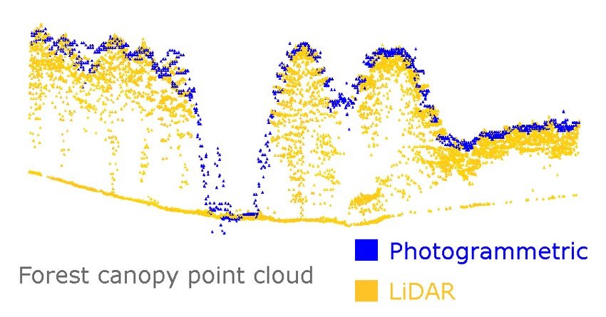
The main advantage of LIDAR over photogrammetry is the ability to penetrate through trees as seen above.